Monday, July 17, 2006

Backpacking in California - June 2006, Part 6


(continued from "Backpacking in California - June 2006, Part 5")

The next morning, we packed up. Our Sierra trip was nearing the end, but we still wanted to make a few stops in Kings Canyon National Park and Sequoia NP.

Kings Canyon National Park is even more beautiful than Yosemite (in my opinion). Although hanging waterfalls don't slap you in the face at Kings Canyon, the ecotones and vegetation, as well as the sheer granite cliffs with the river running below are far more impressive. I saw more vegetational diversity at Kings Canyon than I did at Yosemite. It makes me wonder if Yosemite is too managed (i.e. less fire & other habitat management activities in exchange for more human-related attractions [the Valley is a good example]).

The Kings River was raging due to the snowmelt. If a person were to slip into the river, they would be long gone and dead before they could be pulled from the river. The Kings River cuts through the granite cliffs of Kings Canyon to a depth of 8,000 feet. This is deeper than the Grand Canyon. Photos cannot do this place justice. It is awesome. John Muir declared that Kings Canyon rivals Yosemite in granduer and beauty. Perhaps it's good that few people visit this national park.

We hiked a trail at Road's End (can't remember the name of the trail at the moment). It followed the valley and river. It was so beautiful. I would have loved to stay there forever. We definitely want to go on a backpacking trip in Kings Canyon next time and skip Yosemite.

(to be continued...soon)

General Sherman is the largest tree in the world (by volume). It stands 274.9 feet high and the circumference at its base is 102.6 feet.


Wednesday, July 05, 2006

Backpacking In California - June 2006, Part 5

(continued from "Backpacking in California - June 2006, Part 4")

We left Yosemite and went to Giant Sequoia National Monument. The pace was much slower there. It's amazing how many people go to Yosemite, but how few go to Giant Sequoia NM, Sequoia NP and Kings Canyon NP.

Giant Sequoia National Monument is a new national monument that was established in 2000 from US Forest Service land. USFS still manages it - which I find strange that a multiple-use resource agency is in charge of protecting and preserving sequoia groves which are so precious and endangered. I think Giant Sequoia National Monument might be safer from logging & other natural resource extractions if it were managed by the National Park Service!

The lack of crowds is really nice and peaceful. We set up our tents in a very quiet campground in Kings Canyon National Park and then went to check out General Grant.

Notice in the picture the fire scar. Because the bark is so thick, fire usually doesn't harm an older sequoia. I took this picture because in the forefront, the new generation of General Grants are establishing themselves! They'll eventually be thinned out due to fire, but at least one will survive to replace General Grant when "he" is gone. Nature has a way of taking care of things!

As is the case at most of the sequoia groves, a railing has been built to keep people away from the trees. The main reason to stay away from the trees is because of their shallow roots. If everyone walked up to the base of the trees, then the soil would get compacted, which inhibits oxygen intake, and the roots would be damaged. Even though seqouias are huge, they are only being held in place by a shallow root system! So remember to stay on the designated trails.


There are some interesting things that you are allowed to touch and get near. For example, you can walk into the burned-out center of the Fallen Monarch. This tree fell long before the area was discovered. But once found, settlers used it for housing, a hotel, and a saloon! And the US Calvary housed 32 mules - inside the tree! You can walk through it and see what it must have been like to live under the shelter of the Fallen Monarch.

The Centennial Stump is a sad piece of sequoia history. The tree was chopped down in 1875 to prove to the masses in the eastern US that such large trees actually did exist in the West. The tree was cut into pieces, shipped back east to be displayed at America's Centennial celebration in Philadelphia. You can still see the stump from the General Grant trail.

Take a virtual photo tour of the General Grant trail: www.nps.gov/seki/grantwlk/gg1.htm

We finished our General Grant exploration just as it was getting dark. Back at the campsite, we relaxed in the solitude. There was plenty of downed wood to make a good fire. The low was somewhere around the upper 30s so the fire was much appreciated. I read through my Sierra field guide, while Vince read a book and Scott put the final touches on some of his sketches.

(continued on "Backpacking in California - June 2006, Part 6")


Tuesday, July 04, 2006

Backpacking in California - June 2006, Part 4

(continued from "Backpacking in California - June 2006, Part 3")

We completed our backpacking portion of the trip. This is the view where our trail returned to the Valley area. We didn't come out here because we backtracked. But this would have been awesome to descend upon through the various ecotones. I'm bummed that we missed this part. But at least we got to see the view (from the car!). This is from a pull-out parking area...so Yosemite visitors don't have to trek into the wilderness to get views like this...they just drive up to the views...kinda like a McDonalds drive-thru. At least it's accessible to all; which garners support for our National Park system.

We spent our last night in Yosemite at the Backpacker's Campground by the Merced River.


It's free and available on a first-come, first-serve basis for backpackers to spend the night before or the night directly after a backpacking trip into the wilderness.


Scott enjoying a cup of gourmet camp coffee. I think he looked like a...from Star Wars.

We packed up our gear and loaded the car. Made a stop by the Village in order to visit the museum. Scott got to talking to the docent about the photography exhibit. As we left, nausea came over me. I didn't think I could handle the restrooms so I walked over to a secluded, wooded spot and l found a Sequoia to lay under. Mosquitos were swarming all around me but didn't bite me...however, they were punishing Scott and driving him mad. I tried to stay still to see if the nausea would subside. Other than feeling like crap, it was peaceful. Finally I started feeling good enough to get in the car. We went to check out Lower Yosemite Falls. I spent another 30 minutes laying in the car. As I began to feel better, I did some birdwatching from the car. Very goofy, I know. The birds made me feel better! I saw my first Acorn Woodpecker.

We slowly sauntered down the trail to the Lower Falls. Finally a chance to see close-up what we were viewing from above on the Pohono Trail. It was beautiful. There was a plaque with a quote by John Muir, "As long as I live, I'll hear waterfalls and birds and winds sing. I'll interpret the rocks, learn the language of flood, storm, and the avalanche. I'll acquaint myself with the glaciers and wild gardens, and get as near the heart of the world as I can."

"Brought into right relationships with the wilderness, man would see that his appropriation of Earth's resources beyond his personal needs would only bring imbalance and begat ultimate loss and poverty by all." We should consider John Muir's comments everyday...


(continued on "Backpacking in California - June 2006, Part 5")

Backpacking in California - June 2006, Part 3

(continued from "Backpacking in California - June 2006, Part 2")

We continued our hike to Taft Point and the Fissures. I didn't know what to expect. In fact, due to all the downed trees and wet areas, we had to divert from the trail a bit and we missed getting back on it. We saw an opening of granite so we walked out onto that so as not to trample any more vegetation. The opening sloped down for a great distance. We picked up the trail again in the opening and followed it to the Fissures. WOW! If you're afraid of heights (especially visually-observing that you are several thousand feet up looking over the edge of a chasm) then this is not the place for you to hang out! The Fissures are a split between the granite that allows you to look down to the Valley floor below. There are several boulders wedged in the narrow breaks - left over from the last Ice Age glaciers. (Notice the tiny person at the edge of Taft Point).

Taft Point is equally impressive. There is one rail next to a USGS survey marker. That railing is the only thing between you and the precipice below. I didn't trust my equilibrium so I got on my belly and inched up to the edge for a gander over. Kinda made me queasy.

[When Yosemite was a young national park, Red Firs were lit afire and pushed over the edge (I believe from Glacier Point) to the valley below in a nightly tourist attraction called Firefall. In addition to that spectacle not being the charge of the National Park Service, it created traffic jams, damaged plants and the meadows below, and probably started wildfires. Can you believe that this practice didn't end until 1968!]

After looking mortality in the face, we hit the trail again. We only had a few more miles to go to get into the wilderness area; to the place where we would set up camp. The trail left the wide open area and passed on into dense forest. Then finally we came to Bridalveil Creek. There was a nicely-crafted bridge that crossed over the raging snowmelt water. Photo op!

We found a site that was already established and was about 300 feet from the creek. We used downed logs to walk on so as to minimize the trampling upon the fragile plants. (It's a hard life for the plants at that elevation...and they have such a short growing season...).

We set up camp, relaxed and filtered some water from the creek. As dusk approached, the temperatures fell significantly so we built a small campfire. We made dinner (freeze-dried dinner!) and joked around until late at night. We were halfway waiting for a bear to come and take one of us away. We placed our bear canisters far away from camp but I'm sure if a bear were around, it probably would have visited us.

Instead of making a 30-mile loop like we planned, we backtracked. It's a good thing that we had a hike in with clear skies because the hike out was shrouded in clouds, mist, fog.
So we missed the views, but walking through the clouds was neat. It made all the greens look really bright. We felt like elves walking through an enchanted forest...
We hiked back to Taft Point and dropped Scott off there with the backpacks. There were a few breaks in the clouds so we could see a little bit off in the distance. But then the clouds would rush back up and envelope us. Vince and I hiked several more miles back to the car. We were practically running because we were so light without our packs. We drove the car to a different trailhead and hiked back to Taft Point. When we returned to pick up Scott, he was shivering because it had gotten so cold in the cloud and mist. I couldn't help but laugh at him. We were sweating!
(continued on "Backpacking in California - June 2006, Part 4")

Backpacking in California - June 2006, Part 2

(continued from "Backpacking in California - June 2006, Part 1")

All the crowds remained below in the Valley or at Glacier Point but we passed just a few day-hikers on our trail. We only saw 2 other people backpacking into the wilderness area. Maybe it was an anomaly that there weren’t many people. I’m thinking people have curbed their vacations due to the high (and ever-increasing) gas prices. We didn’t mind the lack of crowds. That just meant better views for us to enjoy!

We pulled off the trail because there was a super view of Yosemite Falls. Scott did a watercolor and I propped myself up against a downed Lodgepole Pine and took a catnap. One of my favorite things to do is to lay down on the ground in the wilderness and either sleep or just listen to nature. It's the most relaxing thing to do EVER!

Look at the awesome view down to where Scott was standing. The landscape in Yosemite makes humans look miniscule.

(continued on "Backpacking in California - June 2006, Part 3")

Tuesday, June 27, 2006

Backpacking In California - June 2006, Part 1

Vince and I flew to L.A. to visit with Scott and Noel for a few days. We met Noel's friend, Thomas who was passing through L.A. on his way to Thailand and points beyond. After a few days of relaxing L.A. sytle, we took Scott (in his car) to Yosemite to go backpacking. Scott had never been backpacking before so I told him I would go easy on him. I only had a 30-mile trip planned but I figured we'd take it slow over about 4 days. Slow, as in...make sure we covered the necessary miles per day, but take plenty of breaks along the way - just make sure we made it to our camping area before dark.

We spent our first night at Wawona in Yosemite. We hiked to the Mariposa Grove to visit the Grizzly Giant. This is a Giant Sequoia tree, the largest tree by volume in the world. The Grizzly Giant is thought to be 2,700 years old! In addition to Giant Sequoias growing so old, they only grow in about 75 isolated groves on the western slopes of the Sierra Nevadas between the elevations of 3,500 to 5,000 feet. They rely on low intensity fires to germinate their cones. The bark is so thick (up to 2 feet!) that fire rarely ever severely damages a Sequoia. Amazingly, these giants have shallow roots - which is a good reason to stay away from the trees so that you don't compact the soil and damage the roots! Imagine, shallow roots anchoring something so tall and massive!

Scott brought along his water color/sketch pad and chronicled our entire trip. He's a very good watercolorist. As he would sketch or paint, people would stop by and look over his shoulder; offering him compliments. Vince and I joked about starting a scam where we would act like we didn't know Scott, then we'd walk up once a crowd amassed, and then offer him money for his art. Then maybe other people would pay him...and that would pay for the gas to go on this vacation (at $3.80 to $4.09 a gallon, we needed help)!
In preparation for our backpacking excursion, we rented bear canisters. These are required in most of Yosemite and recommended in all of Yosemite. The black bears have become wise to the follies of humans and our processed, easily accessible food. Warnings are posted all over Yosemite telling people to place food and other scented items in the bear boxes located at all campsites and parking areas. When backpacking, a bear canister is required. It's big, bulky and adds plenty of weight to your pack. But in my opinion, it is well worth the $5 rental fee. We transferred all our freeze-dried food into ziplock bags, eliminated any trash beforehand, and we were able to fit all our stuff into the canister. It actually helped us become more organized.

As we were travelling to our trailhead for the 30-mile killer hike (loop), Scott came up with a better route that cut some distance and heartache off the trip. Instead of starting our hike in the Valley at the 4-mile trail (which sounds brutal), he decided we should start at Glacier Point. This still meant that once we reached the end of our trip, we would have to hike into the Valley to catch a shuttle and ride it back to Glacier Point, or take the 4-mile trail back to the car. But it at least gave us some options.

Even before we could start hiking, Scott pulled his sketch pad out and documented the fabulous view from Glacier Point. It was breath-taking I do admit. So I rested, even before we put forth any exertion on our hike, while Scott documented. Once we finally started hiking we saw even more beautiful vistas. In fact, that is the reason I chose the Pohono Trail. I figured if we were in Yosemite, we should see all the highlights we could from the trail. We were not disappointed. The views made the physical suffering worth it (although the hiking wasn't terrible-strenuous).

(continued on "Backpacking in California - June 2006, Part 2")

Monday, June 26, 2006

Belize 2006 - part 2


(continued)
We went snorkeling with nurse sharks and stingrays. That was really neat. Now I can officially use the mafia term “swimming with the sharks!” We got completely baked – to the point that it hurt too much to even think about snorkeling on another day. We didn’t want to use sunscreen because we were concerned with polluting the water – especially swimming around the reefs and its inhabitants. I guess that’s the price we had to pay.

Caye Caulker used to be a reef. In fact, that's how some islands are formed. A reef builds up with dead & alive life forms. Eventually it surfaces, some mangrove trees grab hold and begin to grow, detritus and soil/sand are laid down and voila! a barrier island is born.

So we spent the rest of our time laying in hammocks, riding bikes, sitting on the beach, looking at the plants…

We rented bikes, just for fun, because we actually didn't need them in order to get around the island - seeing how the only portion of the island we needed to travel was only a mile in length. And, Caye Caulker is only about 1/4 of a mile wide!
As a note, CC is actually two islands now because Hurricane Hattie split it in two. The northern half has no electricity, etc. and is only inhabitated by Rastafarians (as far as I could tell). The spit isn't too wide, but the few people who live on the northern portion take a shuttle boat across in order to buy and trade goods. These two pictures were taken at the spit. Look further down this entry for an aerial photo of Caye Caulker and the spit (in the center of the island). It is interesting to see where the development is, and also to note that at least half of the island retains native habitat.

One day, we took the ferry over to Ambergis Caye to San Pedro. It was not impressive. Very busy with all the golf carts zipping around. And loads of tourists - such as ourselves! It still retains a bit of island charm, but seems to probably be losing a lot of it with the hectic urbanish lifestyle. We didn't stay there long. Just long enough to walk around a bit and eat lunch. We were very glad when we made it back to "home" Caye Caulker. (Vince on the ferry returning to CC).


Although CC probably can't claim sunsets as good as Tucson, Arizona, they can claim some good sunrises. Vince and I woke up at dawn in order to catch a sunrise for our memory banks! We were actually cold. The temperature was around 60-65 degrees. What can I say...we're wimps!


As time neared for our departure - and a return to our "real world," we tried to soak up every bit of CC that we could. We stayed out most of the day just walking around the island. We splurged for a nice dinner by candlelight and a late night walk on the beach.

When it came time for us finally to depart, we put our backpacks on, and walked to the airport. I wish it were that easy at home! We followed the beach path to the airport and caught a jungle plane back to the Belize City International Airport.
The flight was interesting because we could see the reefs, the layout of Caye Caulker, and finally the mainland.

I found it very interesting also to view the land use patterns on the mainland. Lots of jungle areas around Belize City have been cleared out for development or agriculture. Luckily, conservation is a high priority for the Belizean government. Forty percent of the country is protected, and their population is small enough right now, which keeps development pressures low. Let's hope that Belize can continue to place a priority on conservation and ecotourism.

Sunday, June 04, 2006

Belize 2006 - part 1

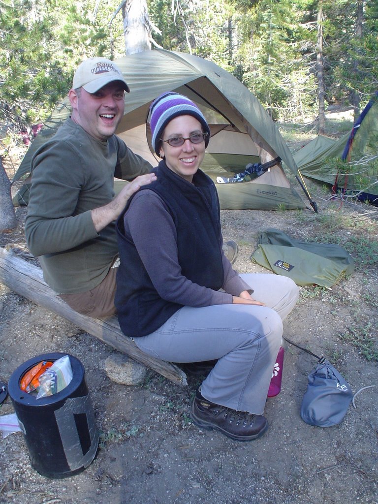
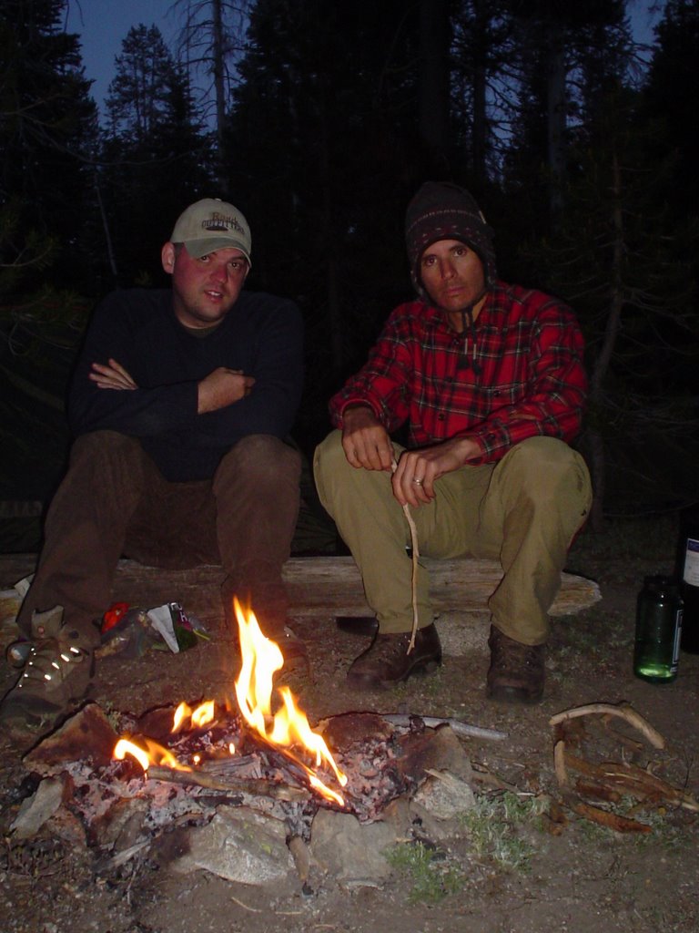
Vince, myself and my father took a trip to Belize. We had been wanting to go there for several years but kept putting it off. In my father's youth, he travelled extensively in Central America. Now in his older years, he would like to go to some of the countries that he missed. We were happy to oblige. We've travelled to Europe, Scandanavia, Canada, Mexico & across the US. Plus Vince has travelled alone to Nepal, Australia and India. Now we would like to focus on travels far south of our border.

Finally we decided to stop talking and start travelling! We set out in January 2006. I am an
avid birder, which was the main reason I wanted to go to Belize. Vince and my father were more interested in the archaeology. Of course we were all interested in that, as well as the culture and natural beauty of Belize.

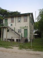
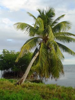
I located a lodge in a small fishing village called
Crooked Tree. It caters mostly to birders and ecotourists. Crooked Tree (CT) is 33 miles north of Belize City but it is a world away! The village sits on a lagoon that is the prime place for water and shore birds, as well as neotropical migrants and resident passerines. CT didn't even have road access to Belize City until 1984 when the causeway was built. Before that time, people made the trip by boat.

CT is a completely walkable village. People do have cars but there are not too many. People mostly walk, ride a horse, or take a boat. There is only 1 policeman and I think he must mostly be bored...which is a good thing! I doubt there is much crime there because the people living in the village all know each other, are family, and/or are friends.
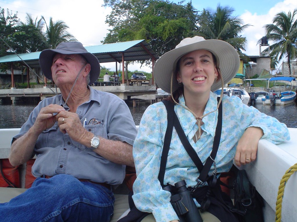
We stayed at the Bird's Eye View Lodge, tucked away on the edge of the village on the shores of the lagoon. Verna & her brother Lenny were excellent hosts. Every evening we had delicious home-cooked meals prepared by Stephanie and her staff. (We could have eaten every meal there but we aren't used to eating 3 meals a day!). Verna kept us entertained with colorful and funny stories. Lenny impressed us with his knowledge of the local flora and fauna - especially the birds. (The birding in Belize is amazing...such diversity...and they're everywhere!) Everyone at the lodge and in the village were beyond friendly. It was like we had known each other for years.

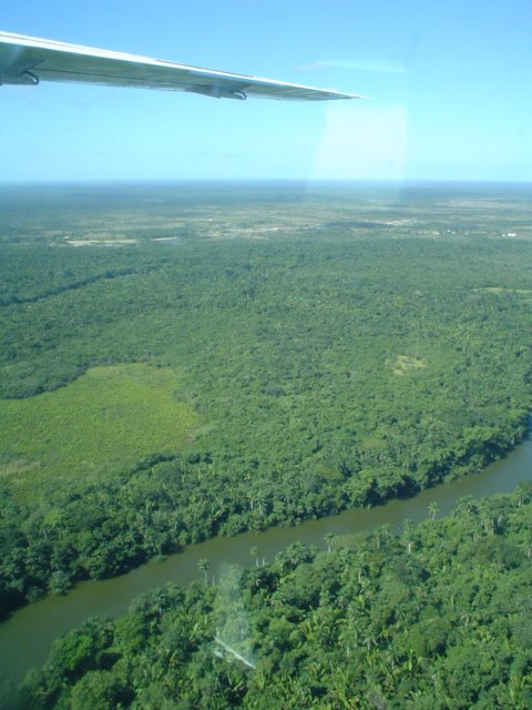
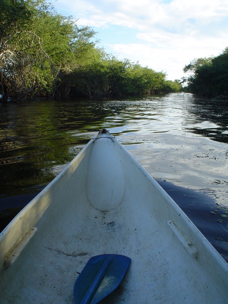
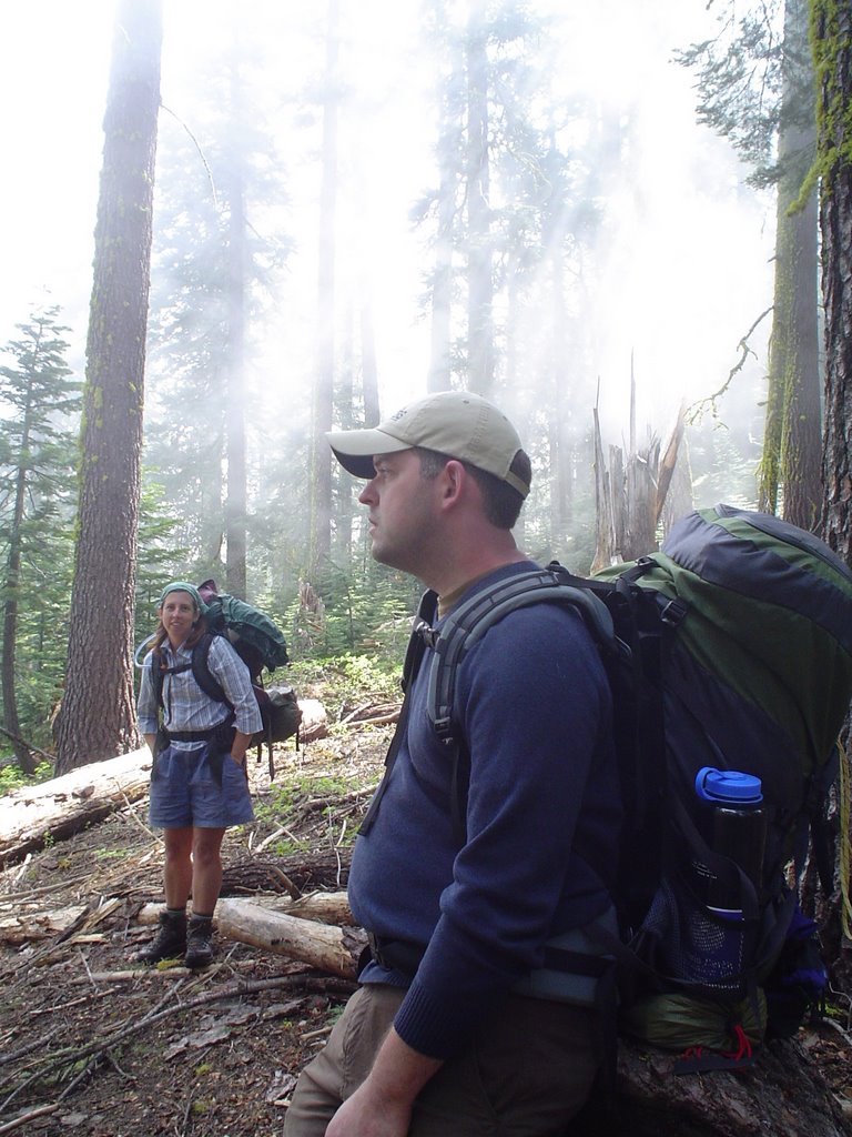
We took a 30 mile boat ride up the New River to Lamanai, one of the longest occupied Mayan sites - 3,000 years. The boat zigzagged and wove along the river. It was beautiful scenery through jungle habitat.

We passed Cohune palm forests and marsh areas. Along the way, we stopped to look at crocodiles and turtles sunning themselves upon the logs. The boat dodged in and out of rain showers but we dried quickly.
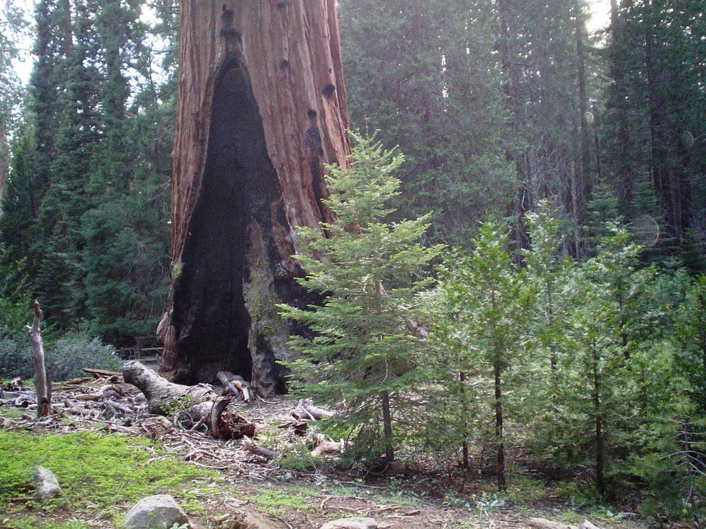
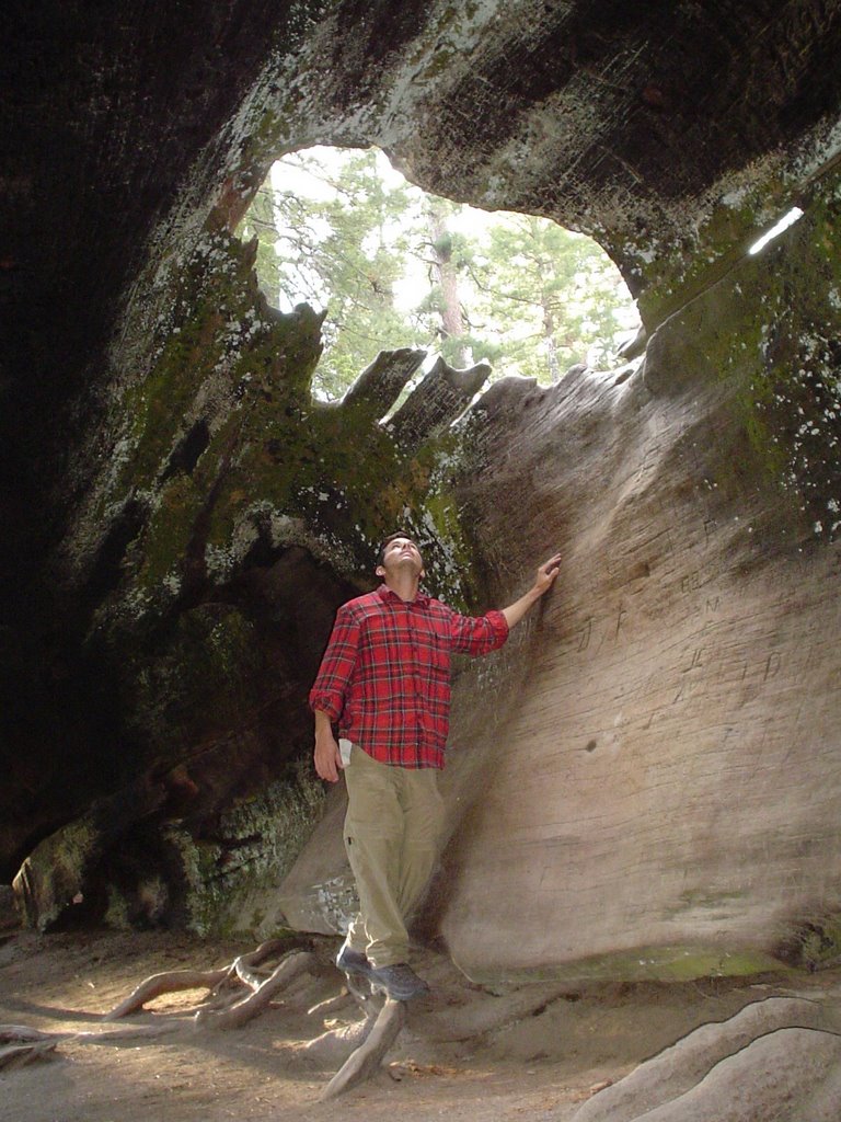
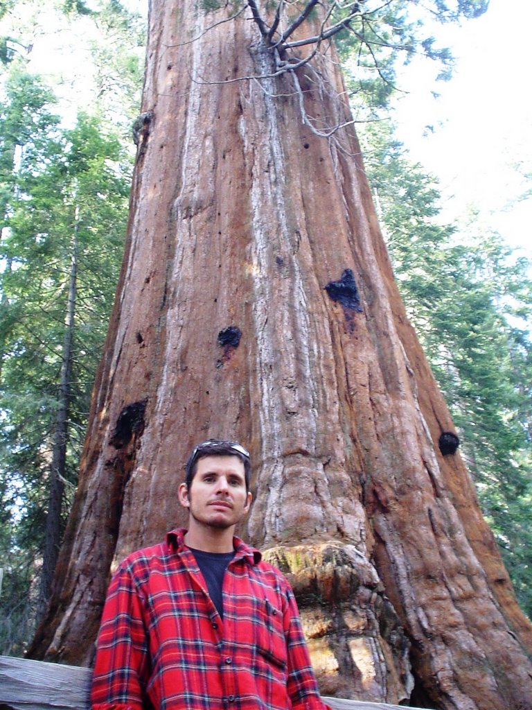
Our arrival at Lamanai lagoon was dramatic because of the view of the Mayan ruins pushing up through the tall tropical broadleaf forest trees (aka jungle). From out in the lagoon, we could see a jabiru stork nest. It was the size of a Volkswagon! These birds are the largest flying bird in the Americas. They stand 5 feet tall and have wingspans of 10 to 12 feet! Lamanai means "submerged crocodile" in Mayan. The site was occupied as early as 1500 BC. Mayans lived here until the arrival of the Spainards in the 16th century.

We walked around Lamanai, saw howler monkeys - but I couldn't get a good picture...bummer. When we reached the Lag Temple, we were crazy enough to climb it. It wasn't so bad climbing up the steep temple and the views were spectacular across the jungle. However, after seeing the views that the Mayan people saw, the climb down became a reality!

It was a nerve-racking experience. We needed total concentration. I tried not to look down past my feet or to look around to the sides.

One slip could have sent us tumbling to the earth like a sacrafice gone awry! And if we were alive after the fall, we probably would die before we were rescued & taken to Belize City.
When our feet touched the earth again and we gazed nearly vertically up at where we just descended from, we were grateful for the experience and grateful to be down safely.
On the boat ride back, we passed by the Mennonite farming community of Shipyard. The Mennonites provide most of the dairy and chicken for all of Belize. We also passed traditional fishermen in dugout canoes which were gently gliding along the water surface - until we came along.
When we reached Orange Walk, Lenny picked us up and took us on a short tour through the town and to look at the sugar cane factory - which is the only one now open in the entire country - hence the long lines of trucks waiting to drop off their cane. The country is divided into 4 districts and each is assigned a specific time to deliver/drop off the sugar cane. Trucks would wait in line up to a week to unload! Drivers either sleep in their trucks or leave the trucks parked in line and get a ride back to their home; then come back in a week.

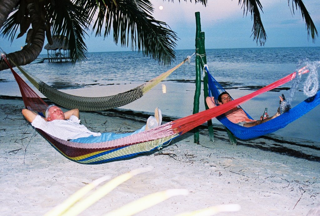
Back in CT, Vince and I did a lot of birding and even visited with the village crocodile - who's been accused of eating the village chickens! One day we hired a local man and his horses and took a 3 mile horseback ride through the outskirts of CT. Although there was hardly an elevational climb, there was a noticeable change in habitat from the jungle forest & lagoon to the pine forests. The difference of plant communities is due to the soil type.


The horseback riding was enjoyable (although I'm not much of a horse person). I was trying to bird from horseback and it wasn't going too well. As soon as I would see a bird and pull my binoculars up, the bird would be gone and I'd be bouncing on down the gravel road. Oh well. By the end of the ride, my "bum" was very sore and I could hardly walk. I had to use the rest of the afternoon to relax, visit with Vince and my father, look at birds - from a stationary position! - and finally try bird watching from a canoe. (I never give up!)

Yet again, not a good idea if you actually want to identify the birds instead of a blob. But we did have one really cool close encounter. We came within 5 feet of a Common Black Hawk perched atop a mangrove. We were able to sneak up on it with the canoe. The canoe route we took was actually a 2-track road during the dry season, but during the wet season it floods and becomes a boat lane.

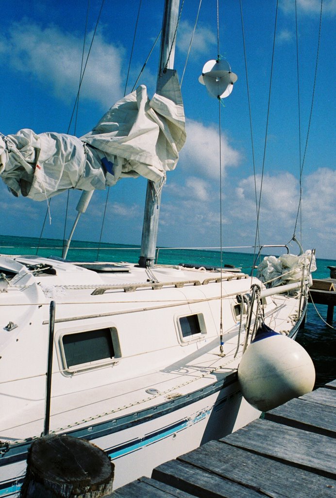
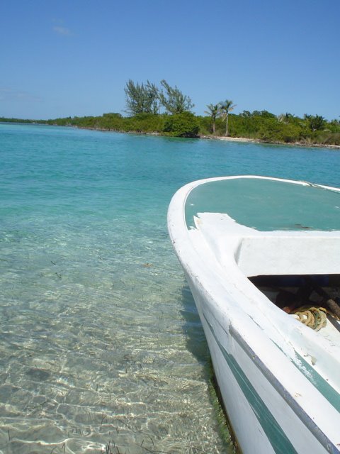
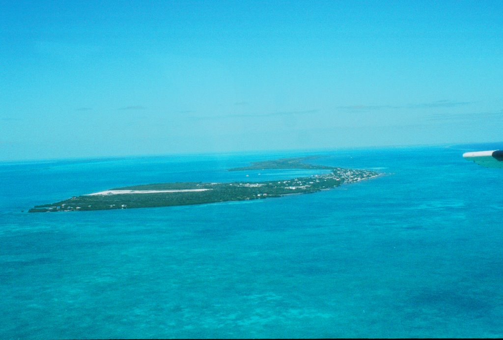
We left Crooked Tree and took a ferry to Caye Caulker - a sleepy island village that sees far fewer tourists than it's twin Ambergis Caye. On the ferry ride there, it began to rain. Our rain gear was packed away and not accessible. The ferry attendant handed out a tarp for each side of the boat. We each had to hold it above our heads (just like the parachute game we played in elementary school)!

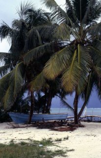
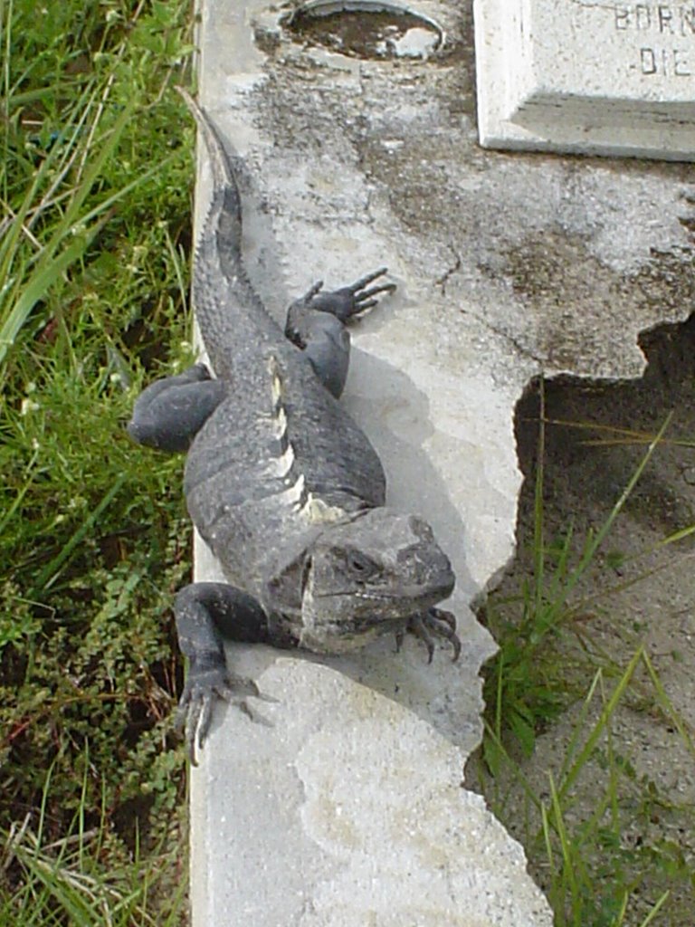
When we arrived at Caye Caulker, we had no idea of where to stay. We started walking along the main street. The island is only about 4 miles long and the main area for accomodations is only about 1 mile long, so we weren't too worried about walking. We just knew that if we walked toward the end of the island, we'd find more secluded accomodations. We took a beach trail through an old cemetery (where we saw an iguana sunning itself every day upon a tombstone) and followed it to the hotel we eventually selected.

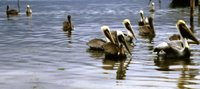
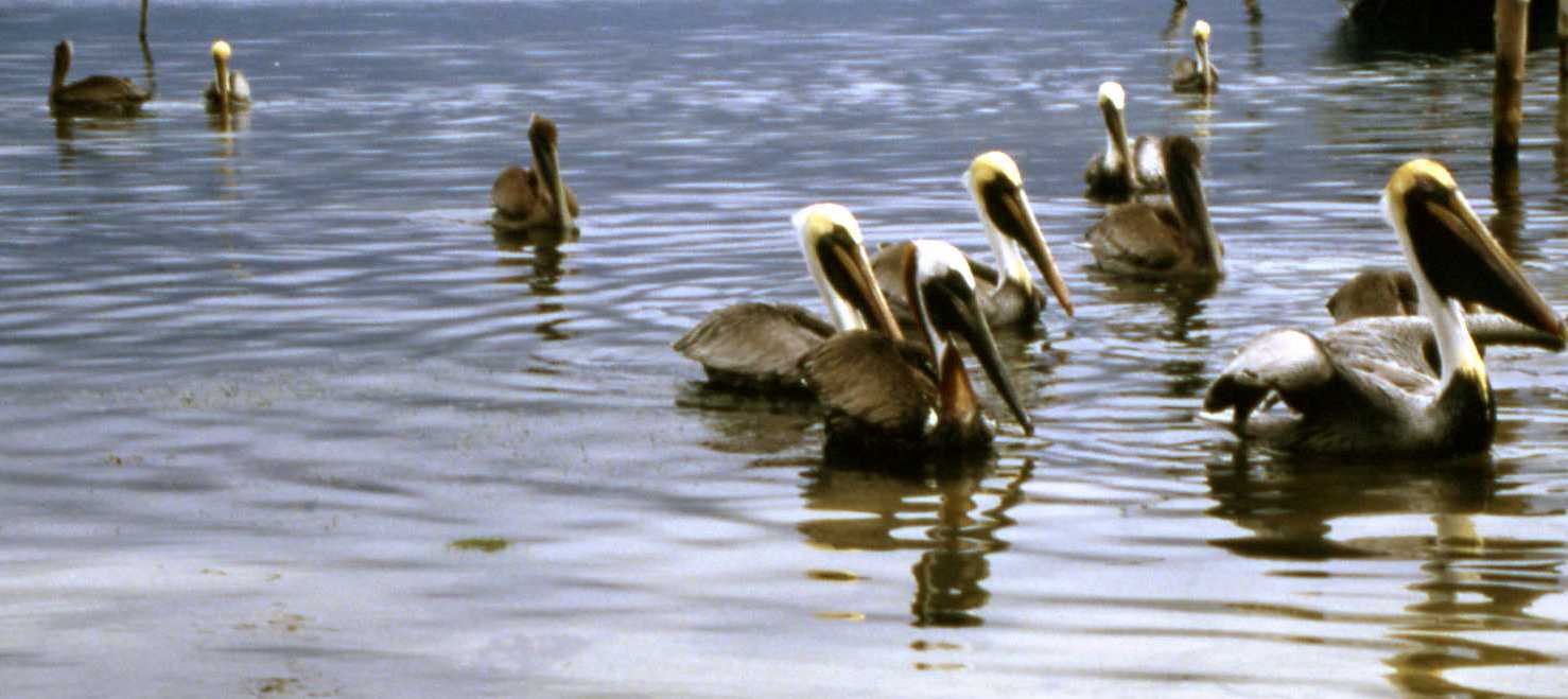
The birding was not too exciting on Caye Caulker but I did see Brown Pelicans, which I always find to be a treat.

Again, on Caye Caulker, we took things slow and relaxed. Nobody moves fast on this island anyways...why would they? There are just a few cars. There is no need to have a car. I can't figure out why anyone would want one. People either walk or ride a bike. A few people drive around on golf carts but not many (on Ambergis Caye - San Pedro, too many people use golf carts and it's a mess and quite annoying. Sadly, it's hard to be a pedestrian there). On Caye Caulker, they do use a mini-fire engine and it seems like it works well for the structures there. I was so taken with the mini-fire engine that I basically chased it around for days until I had a good photo opportunity.

On the islands, they transport and deliver bottled water, cokes, etc. using a tractor.

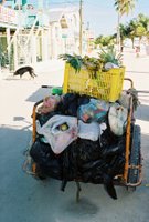
And trash collection is done by entrepreneurs who ride bikes around (note the individual plastic grocery bags filled up with trash).

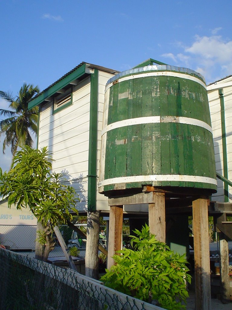
Every house has a rain water catchment system. Although they get quite a bit of rain (as compared to where we live), I'm sure they ration their water.

School-aged kids went to the Catholic school. Everyday after school, the back streets would be busy with uniformed kids walking home. No need for buses or parental escorts on Caye Caulker. All seems safe. The police (only saw 2 of them) rode bicycles and weren't carrying firearms.

We spent our time on the island just strolling around and taking things slow. Every angle is a photo op on CC. The blue water, the island vegetation, the buildings, the friendly people...

Continue on to "Belize 2006 - part 2."